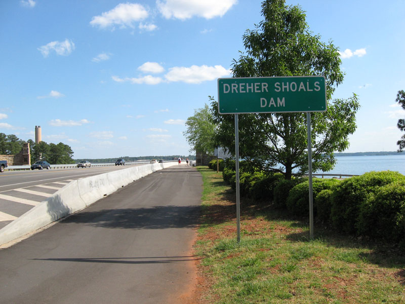
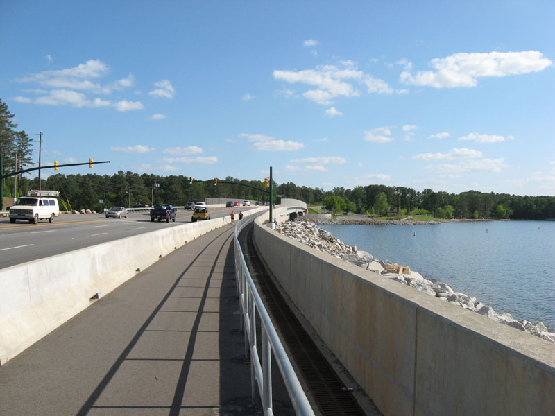
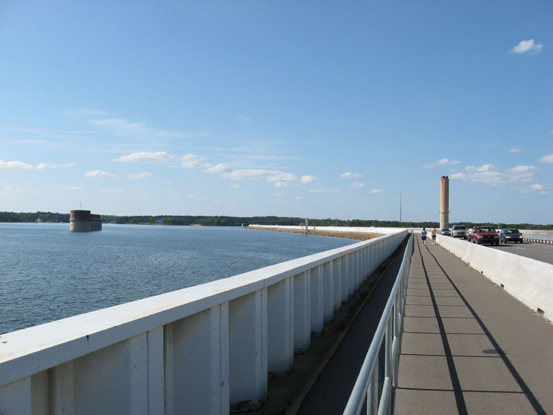
The Columbia area’s newest walking pathway is directly across the top of the Dreher Shoals Dam along S.C. Highway 6. It's a popular place for walking and jogging. The distance is 1.7 miles each way for a total walk of 3.4 miles. The walkway offers spectacular views of Lake Murray and even the downtown Columbia skyline 11 miles away. This pathway was completed after the construction of the new backup dam at Dreher Shoals Dam on Lake Murray (in 2005) and with the widening of S.C. Highway 6 across the top of the dam (in 2007). If you walk on a hot day, be sure to take a cap or hat, sunglasses and water.
Where to Park:
SCE&G South Recreation Area at Dreher Shoals Dam on S.C. Highway 6 near Corley Mill Road; Free parking area (limited space) or park across highway (be very careful crossing busy Highway 6); $3 for main recreation parking area.
SCE&G North Recreation Area at Dreher Shoals Dam on S.C. Highway 6 at Bush River Road; $3 for parking.
CLICK on the pictures below for larger image sizes. (Pictures by Mel Coker in April 2009)
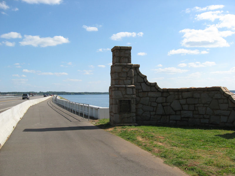
 Irmo Side of Dam |
 Lake Murray Pedestrian Walkway |
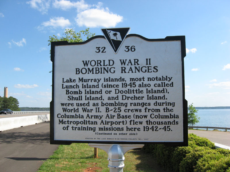 Lake Murray Historical Marker Side 1 |
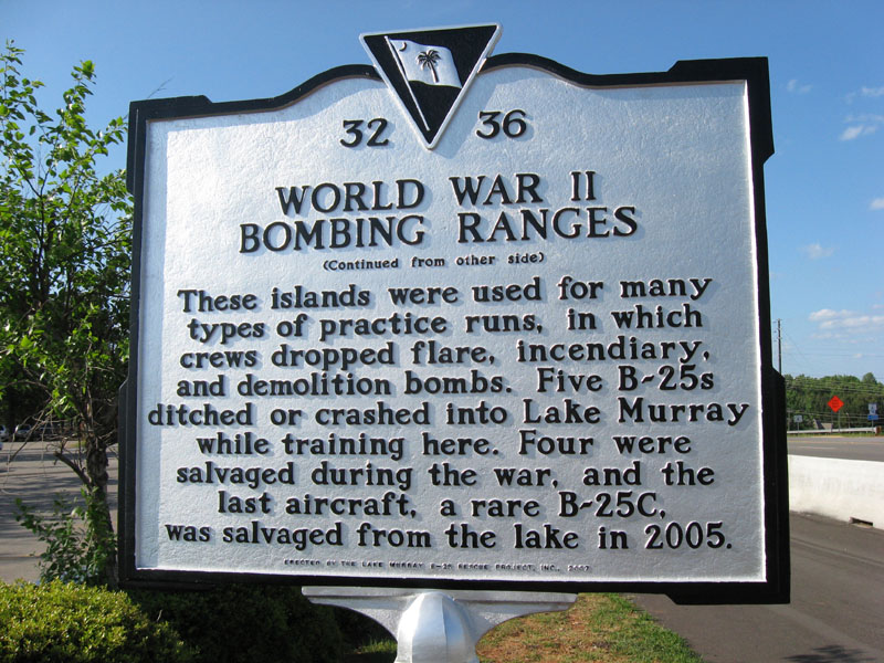 Lake Murray Historical Marker Side 2 |
 Ready to Walk - Irmo side |
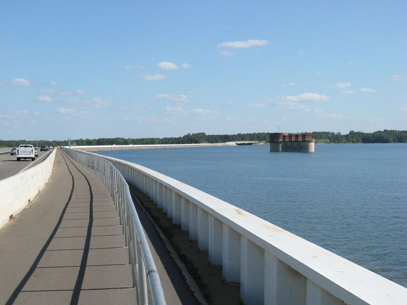 View towards 5 Towers & Lexington Side |
 Almost to Spillway Bridge & Lexington Side |
 View towards Irmo Side |
Photography credit: All photos by Mel Coker. Not to be used without permission or link attribution to this web page
More Lake Murray Information:
Dreher Shoals Dam |
Lake Murray Blog |
Lake Murray eBook in Issuu format |
Lake Murray eBook in PDF format


Lake Murray * Lake Murray SC * Lake Murray South Carolina Lake Murray Guide | Lake Murray information | Lake Murray pictures | Dreher Shoals Dam | Lake Murray Dam | Lake Murray walking | Lake Murray pathway | Lake Murray Dam Walk